Ex-Tropical Cyclone Alfred Update
Published 08 March 2025

Although predicted severe weather has been downgraded, ex-Tropical Cyclone Alfred will bring with it heavy rainfall, risks of damaging wind gusts and flash flooding.
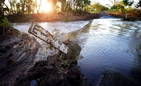
Public and staff safety is the focus, and people should still stay inside and not go out until it is safe. People should wait for the official 'all clear'. If it’s flooded, forget it!
Ex-Tropical Cyclone Alfred is just off Bribie Island and moving slowly west-northwest.
It is expected to make landfall between Maroochydore and Bribie Island this morning before weakening inland later today.
Last night was an anxious wait. Teams in City of Moreton Bay’s Local Disaster Coordination Centre monitored the situation overnight and saw Alfred move close to the coastline at 3am, only to stall and turn back before heading east of Woorim Beach and sitting still offshore. By 6am this morning it was declared an ex-Tropical Cyclone but currently it is looping again offshore.
Currently, 5,500 homes have power out across City of Moreton Bay.
Overnight there were 9 SES calls for support. We expect numbers to increase once advice is given for people to leave shelter and assessments are conducted on the ground.
There is still potential for impact on frequently flooded roads, Council is preparing to mobilising crews to start conducting damage assessment and beginning clean-up work to ensure public safety and begin to check all council facilities so they can be declared safe and ready to reopen.
This has been a massive task in terms of planning, logistics and operations to ensure safety of our residents. City of Moreton Bay staff, with the support of State and Federal Agencies, have worked around the clock to ensure we are prepared and ready for what the cyclone would bring.
There does remain a real risk of flooding, so this situation is not over, and I know we will be able to support people with the excellent planning already in place.
Thank you to everyone for their patience during this evolving situation.
Key Impacts:
Heavy Rain & Flash Flooding:
- Intense rainfall is developing across Moreton Bay islands, Gold Coast, and Scenic Rim this morning.
- Rain will become widespread across City of Moreton Bay, Brisbane, Ipswich, the Sunshine Coast, and Gympie later today and into Sunday.
- 6-hour rainfall totals of 100–130mm, with isolated areas receiving up to 200mm.
- Some areas could see dangerous, life-threatening flash flooding, with 24-hour totals of up to 450mm in higher terrain.
- We are continuing to monitor conditions closely - so we ask the community to exercise caution, stay of the water, monitor conditions closely
Damaging Winds:
- Wind gusts up to 100 km/h possible across coastal and elevated areas.
Stay Alert & Stay Safe
- Monitor the Disaster Dashboard.
- Avoid flooded areas and stay indoors where possible.
- Check emergency updates and warnings from authorities.